Lee mapping project protects county’s past
Staff Photo: Tom Seegmueller
By Tom Seegmueller
[email protected]
LEESBURG — Lee County Marshal Jim Wright and GIS technician Corrie Wheeler are mapping the past to ensure it survives into the future.
Wright has been a historian at heart since his youth. While standing at the Chehaw Monument he said, “I was walking these fields looking for artifacts with the landowners’ permission in 1977.”
During the past three decades, that interest has led him to research and document some of the most historic sites in Lee county and other areas of Georgia.
A collection of some of his finds is on display at the Tharp Governmental Building in Leesburg. The items range from Native American artifacts to military and civilian relics from the early 1800s found at numerous sites within the county.
Wheeler began mapping Lee County sites in 2018, through a summer internship program funded by the Association County Commissioners of Georgia.
“I worked to map the trailer parks in the county and worked on setting the mile-markers on the creek,” she said.
Bailey Williams, a recent graduate of Georgia Southern with degrees in Geology and Chemistry, was this year’s ACCG intern for Lee County. When she was not busy creating maps showing the utility services in the county, she joined Wright and Wheeler in their history mapping project.
The trio rely on a lot of modern technology to locate and map the past. Wright has developed a map overlay system on a tablet that allows him to use a 1938 USDA map showing where roads and structures were located in the county at that time as a guide.
“This map shows where we would be here in 1938,” he said. “The black squares were occupied, the half-squares are part-time residences, and the blank ones are vacant. I downloaded Maprika, and a friend of mine who is smarter than me set this up.”
Maprika combines the details of older hand-drawn or picture maps with the “locate me” feature of Google Maps. Look at Wright’s tablet, and an icon shows your position in relation to any map overlay he has loaded.
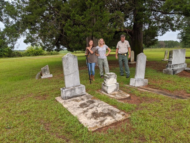
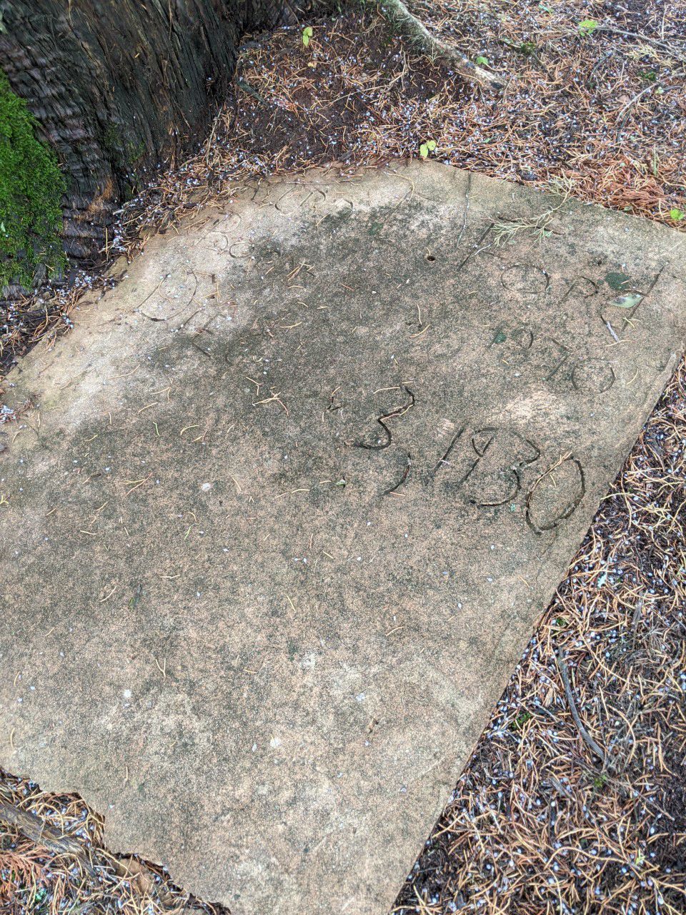
During a recent visit to a family gravesite visible from the road, Wheeler preformed her technical wizardry.
“This Trimble is our new toy,” she said. “It marks this location within a centimeter of accuracy.”
While she downloaded the sites location and elevation, Wright and Williams collected general information on names and the number of graves at the site.
A Trimble device is a GPS-based device that records location and altitude data with great precision. This data can be transferred or “marked” and “layered” into a map overlay system.
“We are trying to locate and map all of our cemeteries, historical markers, our historic sites, and areas of historic interest so we reduce the chances of them being destroyed or damaged with future development or land disturbance,” Wright said. “Sometime people don’t know they are there.”
Wright encouraged the citizens and landowners in Lee County to contact him regarding any cemeteries or historical sites that they might be aware of so the gravesites can be entered into the data base. He can be reached at (229) 759-6000, or email [email protected]. Wright said he wants landowners to know that the data that is entered into the system is secure and not accessible to the general public.
Author

Related Articles

Southwest Georgia artists recognized at packed opening of exhibition
The annual juried exhibition, one of the region’s largest showcases of visual art, features approximately 46 artists and nearly 90 works spanning painting, sculpture, ceramics, photography and mixed media.
Powerful performances drive Theatre Albany’s ‘The Color Purple’
From the street, strands of purple ribbon wind around the white columns of the historic theater, hinting at the story waiting beyond its doors. Inside the foyer, a carefully curated slideshow flickers across a large screen, cycling through the faces of the cast. Some are seasoned performers. Others are stepping onto a stage for the very first time. Teachers stand alongside former students. Parents perform beside their children. People who worship in different churches, work different jobs and come from different corners of Southwest Georgia gather beneath the same lights to tell the same story.
The Worst Job in the Marines: Telling Parents Their Child Was Dead. It Was Also an Honor
Telling a family their child died in combat is something no one wants to do, but someone has to. Christopher Murphy described his service as a Casualty Assistance Calls Office as miserable but vital.